Tập tin:Nasa world wind - teneriffa.jpg

Kích thước hình xem trước: 800×599 điểm ảnh. Độ phân giải khác: 320×240 điểm ảnh | 640×479 điểm ảnh | 1.024×766 điểm ảnh | 1.280×958 điểm ảnh.
Tập tin gốc (1.280×958 điểm ảnh, kích thước tập tin: 120 kB, kiểu MIME: image/jpeg)
Lịch sử tập tin
Nhấn vào ngày/giờ để xem nội dung tập tin tại thời điểm đó.
| Ngày/Giờ | Hình xem trước | Kích cỡ | Thành viên | Miêu tả | |
|---|---|---|---|---|---|
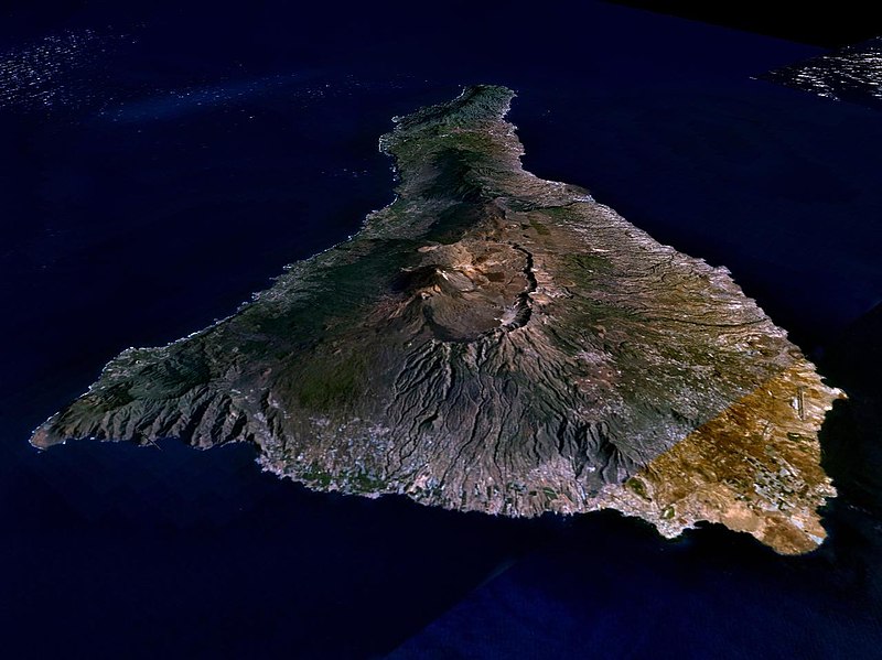
| hiện tại | 08:15, ngày 31 tháng 3 năm 2005 |  | 1.280×958 (120 kB) | Simplicius | {{NASA-PD}} Teneriffa from the west side. One sees Teide (3,700 meters) and the Caldera (2,000 m). To the right hand the new airport. On the left side one sees that there is more humidity and therefore vegetation at the north side of the island. |
Trang sử dụng tập tin
Trang sau sử dụng tập tin này:
Sử dụng tập tin toàn cục
Những wiki sau đang sử dụng tập tin này:
- Trang sử dụng tại ar.wikipedia.org
- Trang sử dụng tại be-tarask.wikipedia.org
- Trang sử dụng tại cs.wikipedia.org
- Trang sử dụng tại de.wikipedia.org
- Trang sử dụng tại de.wikinews.org
- Trang sử dụng tại de.wikivoyage.org
- Trang sử dụng tại en.wiktionary.org
- Trang sử dụng tại eo.wikipedia.org
- Trang sử dụng tại es.wikipedia.org
- Trang sử dụng tại fa.wikipedia.org
- Trang sử dụng tại fi.wikipedia.org
- Trang sử dụng tại frr.wikipedia.org
- Trang sử dụng tại fy.wikipedia.org
- Trang sử dụng tại gl.wikipedia.org
- Trang sử dụng tại he.wikipedia.org
- Trang sử dụng tại hu.wikipedia.org
- Trang sử dụng tại incubator.wikimedia.org
- Trang sử dụng tại it.wikipedia.org
- Trang sử dụng tại mn.wikipedia.org
- Trang sử dụng tại nn.wikipedia.org
- Trang sử dụng tại no.wikipedia.org
- Trang sử dụng tại pl.wiktionary.org
- Trang sử dụng tại ru.wikipedia.org
- Trang sử dụng tại sh.wikipedia.org
- Trang sử dụng tại sk.wikipedia.org
- Trang sử dụng tại sw.wikipedia.org
- Trang sử dụng tại tr.wikipedia.org
- Trang sử dụng tại uk.wikipedia.org
- Trang sử dụng tại zgh.wikipedia.org

